Kenfig Sands — Sker naturist stretch
Kenfig, near Porthcawl, Bridgend, Wales

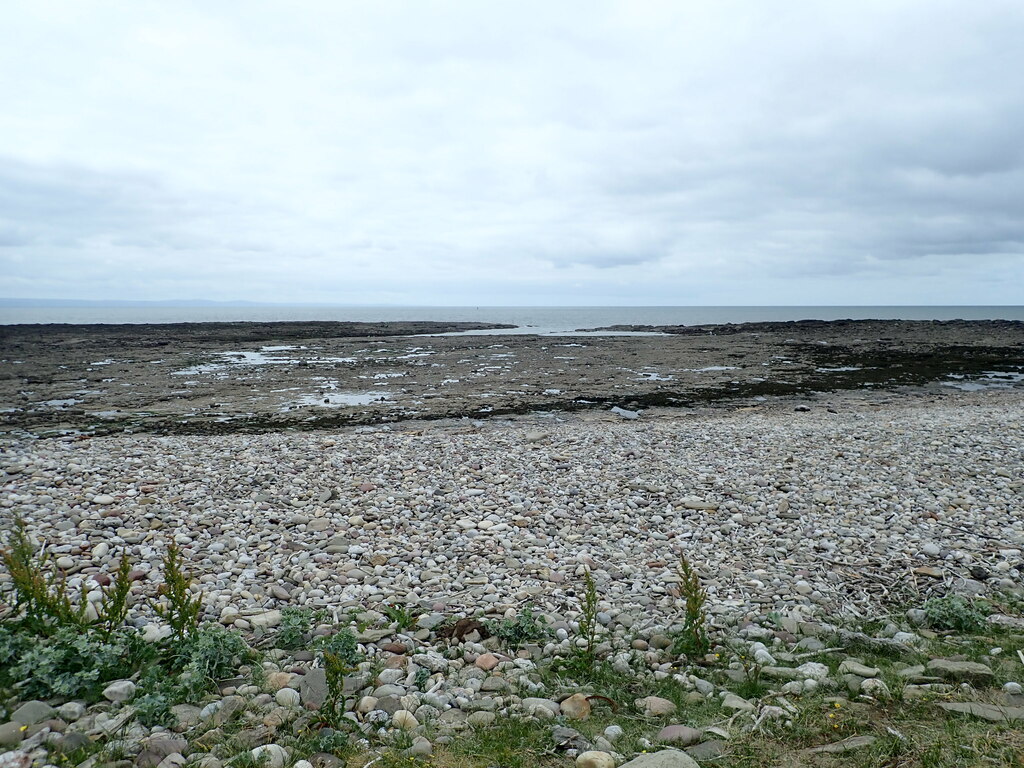


A spacious dune-backed beach with traditional naturist use toward the northern end, south of the Kenfig river. A walk across the reserve and north along the shore reaches the quieter area traditionally used by naturists.
Nudity policy
Customary naturist area; not officially designated
Customary clothing-optional use is toward the northern end; no current official designation was verified.
The reserve centre, lake paths, southern beach and access routes are shared spaces; do not assume the whole reserve is naturist.
Facilities
No facilities on site.
No listed facilities are confirmed on the naturist stretch. Public parking, toilets or refreshments on the approach are described separately below.
Access & visiting
Public beach access on foot; no membership, accommodation booking or beach-admission ticket is required. Any vehicle-parking charge is separate. This is a shared public coast with customary naturist use, not an exclusively nude venue.
Age & supervision
Family eligibility is based on the primary visitor guidance for ordinary public shoreline use, with no separate adult-only admission system identified. No numerical minimum age is published. Adults should supervise children and assess tides, terrain and access conditions; customary naturist use does not establish formal designation or extend to every part of the coast.
Age policy sourceWhen to go
Open coast, with weather, tides and local access restrictions affecting visits; naturist use is most likely in warmer months.
Directions & Parking
Getting there
Start at the Kenfig Nature Reserve Centre near Ton Kenfig. The Wales Coast Path identifies this as the access point for its signed reserve walks.
Parking
Use the reserve-centre car park and read the current paid-parking conditions. Older walking leaflets describe free parking, but the landowner introduced charges; parking and visitor-centre toilets are outside the naturist stretch.
Finding the naturist area
Follow waymarked paths through the dunes to Sker/Kenfig beach; ask at the reserve centre if paths are flooded. At the beach turn right/north and continue along the shore toward the Kenfig river. BN places traditional naturist use roughly 200–400 m south of the river, so do not cross the river to find it.
Where naturism applies
The nude area is customary and unsigned in the evidence checked. The river provides a useful northern reference, but not an official boundary; avoid the busier southern access.
- Allow a long walk: over half a mile through soft dunes, then potentially close to a mile north along the beach.
- Some reserve paths flood in wet weather; use signed routes and current warden advice.
- Protect the dunes and wildlife, carry supplies and keep clear of the river mouth.
Access guidance checked 2026-11-10. Follow current signs and any instructions from the venue or land manager.
Sources & last check
Location, facilities and nudity policy checked against these sources on . This is a desk check, not an on-site inspection.
- British Naturism — customary area, river landmark and beach reference
- Kenfig Nature Trust — current land manager and parking enquiries
- Kenfig Nature Trust — parking charges and Charity Commission review
- Wales Coast Path — waymarked reserve routes and seasonal flooding
From other visitors
Loading comments…
Your comments
Been here? Share your experience, a useful tip or a detail that could help the next person.
Manage comments